Potable Water & Wastewater System GIS Development
Oak Creek Water & Sewer Utility hired Baxter & Woodman to provide advanced GIS consulting services beginning in 2017 and is an on-going collaboration between the Utility and Baxter & Woodman. Our team helped create the Utility’s ArcGIS Online Organizational account, transition from out-of-date software, and deploy secured real-time field data collection devices.
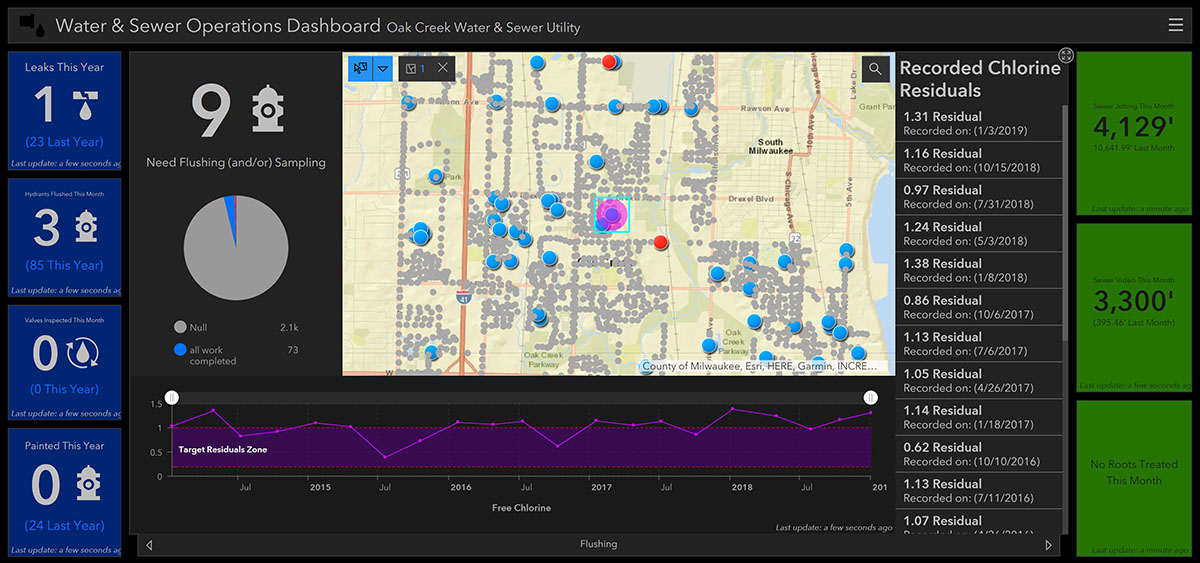
The Utility now has an efficient, forward-looking GIS that provides the flexibility to expand as the need arises and robust enough handle the advanced tools and data analysis the Utility requires. Over the past 4 years, this collaborative team built a robust system of maps and apps starting with numerous Collector for ArcGIS apps, an Operations Dashboard, and a first of its kind utility locate application suite.
After the successful implementation of the Utility’s ArcGIS Online Organizational account, they were ready to take advantage of the tools and functionality to expand and enhance their GIS capabilities. This began with the identification and development of numerous Collector for ArcGIS apps tailored to meet the specific operational needs of the Utility.
Working closely with the Utility’s GIS staff, Baxter & Woodman was able to create and configure a one-of-a- kind Operations Dashboard successfully connecting GIS and field operations to the decision-makers.
Our partnership with Oak Creek Water & Sewer Utility has a proven track record of advanced GIS design and development of maps and apps all focused on saving the Utility time and money while providing critical information to enhance the decision making process.